

 Virtual tour of the passes

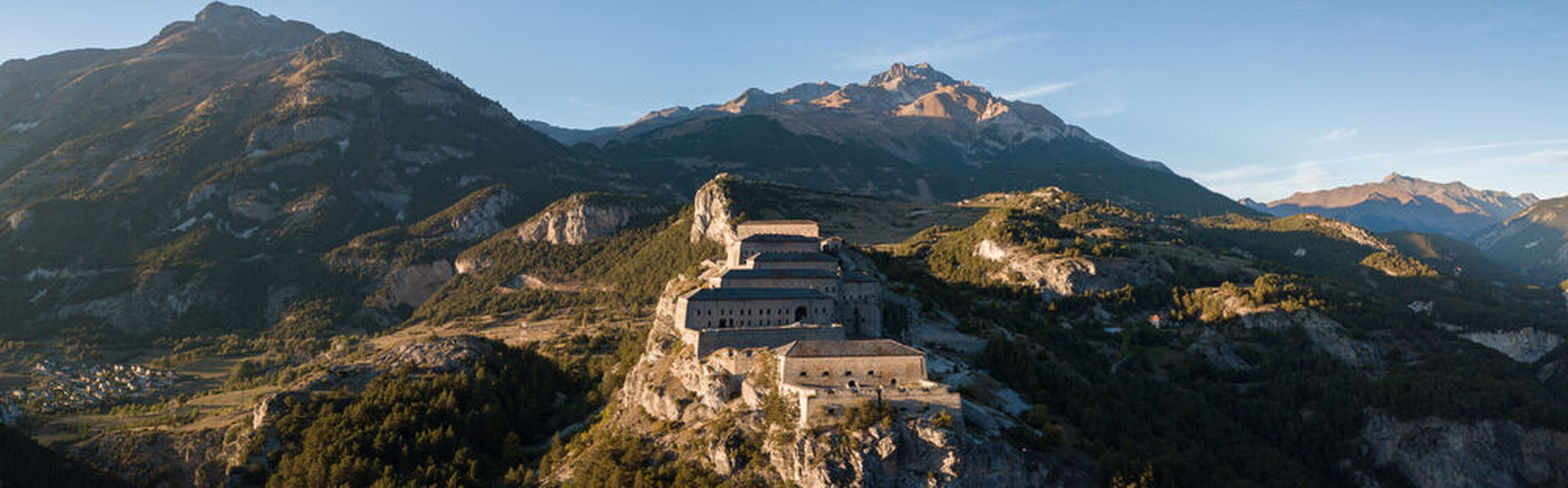
You leave the dynamic little Border town of Modane for a different setting, that offered by Haute-Maurienne Vanoise.
Description
On your road, to your left, the high mountains of the Vanoise National Park and its glaciers, will have your eyes distracted ! The route promises to be pleasant with a remarkable view of the spectacular Fort of Esseillon, as well as the crossing of small alpine villages full of charm.
Période d'ouverture
From 01/06 to 15/10.
Subject to snow conditions.
Itinéraire
- Balisage NON_DISPONIBLE
- Type d'itinéraire ALLER_ITINERANCE
- Nature du terrain Hard coating (tar, cement, flooring)
Tarifs
Free access.
Plus d'infos
Commune :
Modane
Adresse :
Cours Aristide Briand
73500
73500
Commentaires
Vous aussi, écrivez un commentaire !