

 Virtual tour of the passes

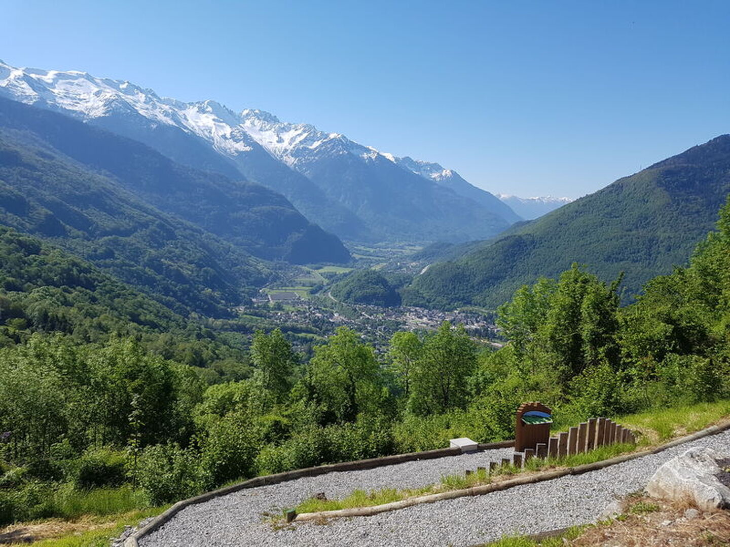
A rarely cycled route through the Lower Maurienne and the Combe de Savoie.
Description
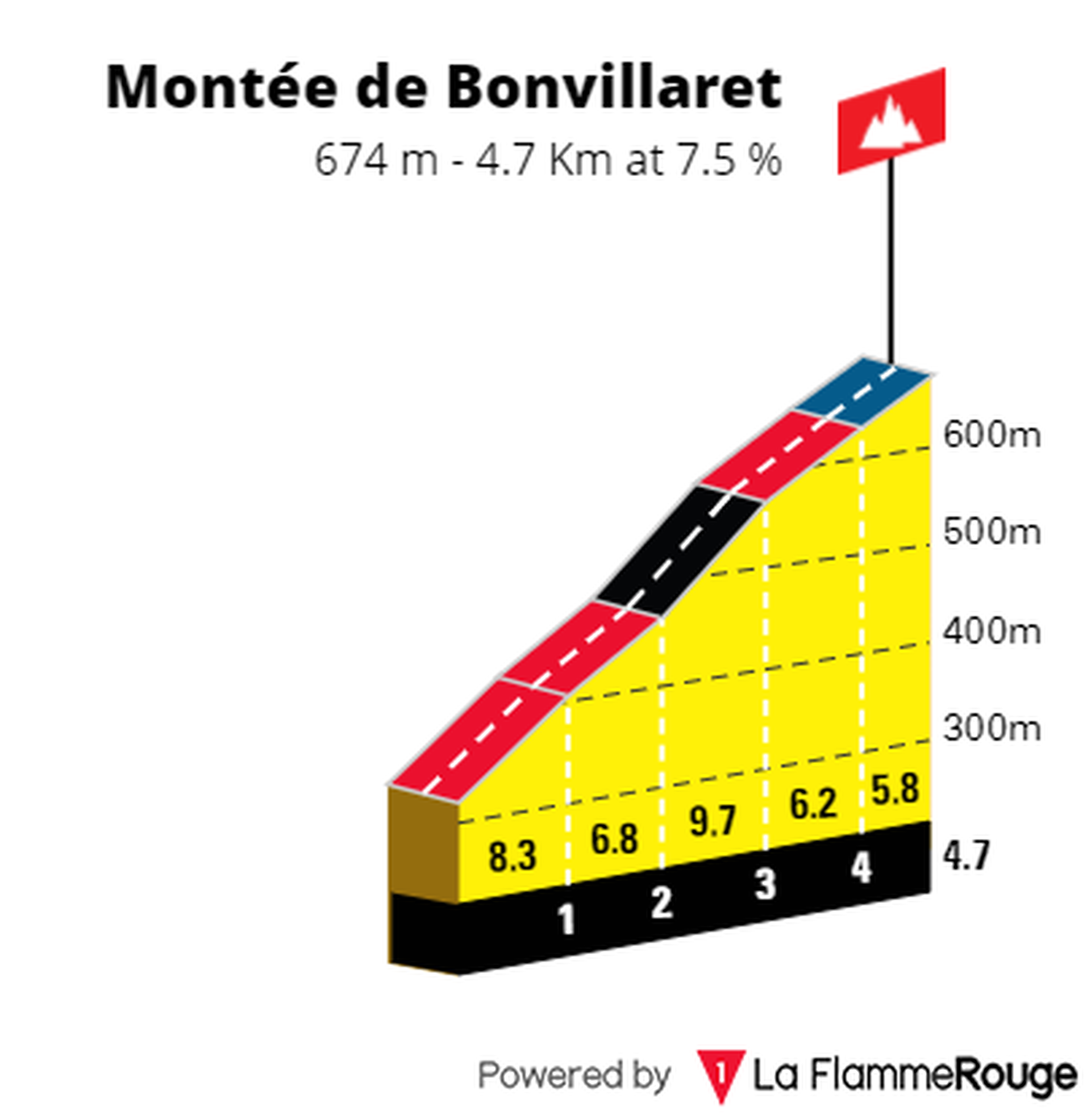
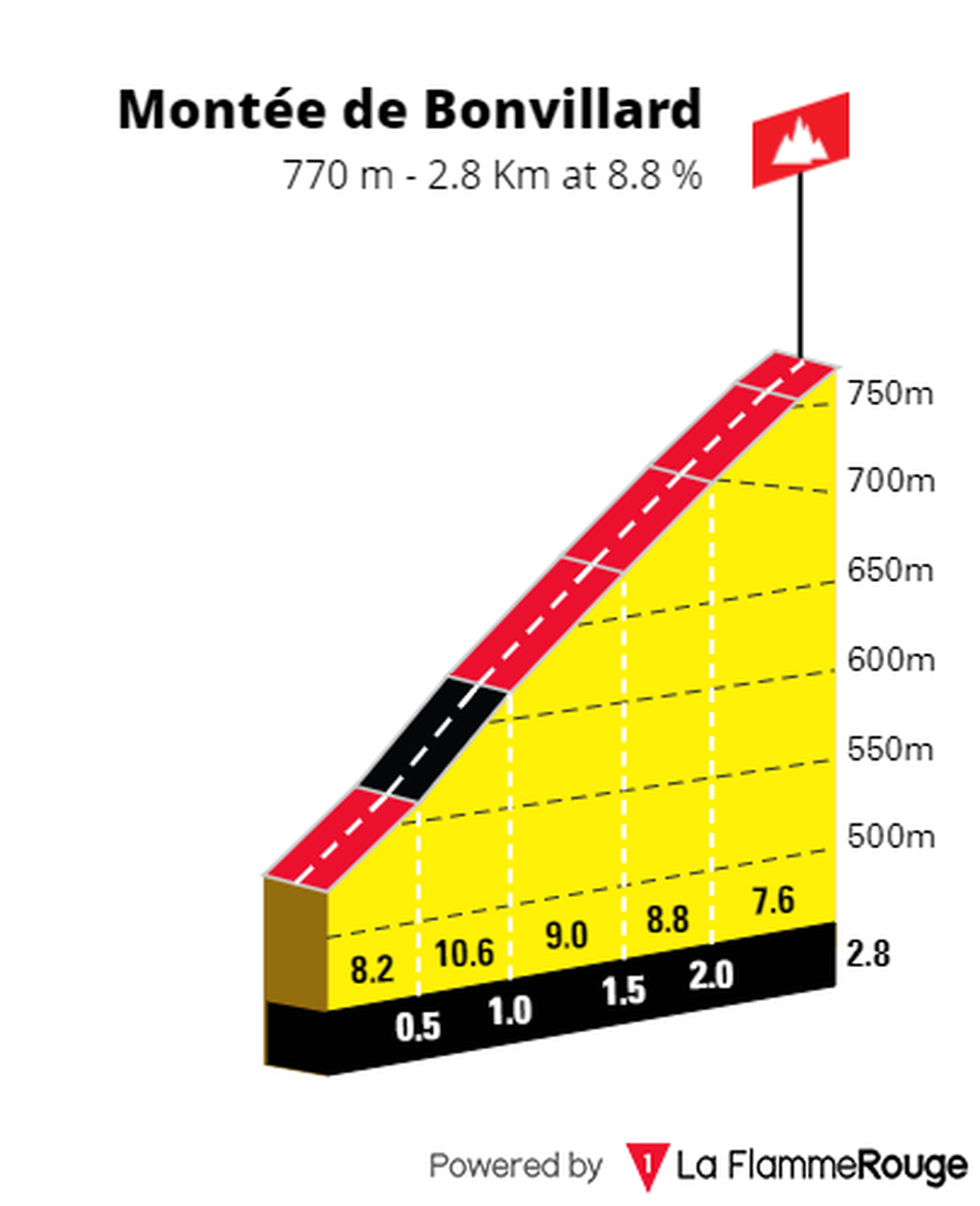
The route goes through the villages of Randens, Bonvillaret, Bonvillard, Le Villaret and Aiton.
You will find fountains in the villages crossed and several restaurants in Aiguebelle and Fort of Aiton. The nearest bike repair shop is located in Albertville.
You will have the opportunity to admire the point of view of the entrance of the valley, at the Fort of Aiton.
Période d'ouverture
All year round.
Subject to snow conditions.
Itinéraire
- Balisage NON_DISPONIBLE
- Type d'itinéraire BOUCLE
Équipements & Services
-
Picnic area
-
Bar
-
Public WC
-
Parking
-
Motorhomes allowed
Tarifs
Free access.
Plus d'infos
Commune :
Aiguebelle
- Aiguebelle
Adresse :
Aiguebelle
73220
73220
Entité d'information :
Maurienne Tourisme
Commentaires
Vous aussi, écrivez un commentaire !