

 Virtual tour of the passes

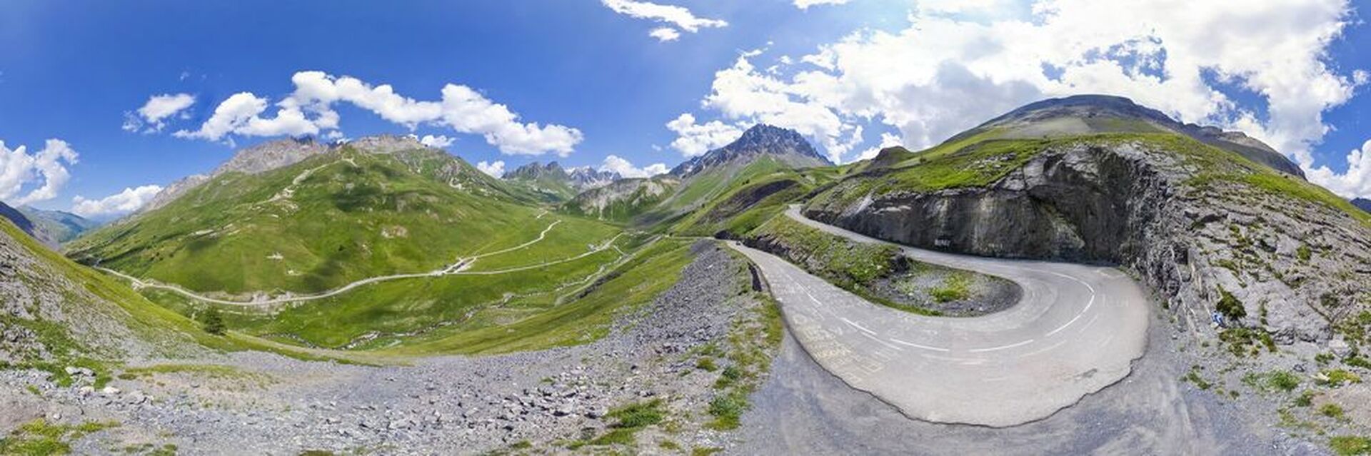
Culminating at an altitude of 2642m, the Col du Galibier connects St Michel de Maurienne and Briançon via the Col du Télégraphe (north) and the col du Lautaret (south). Halfway through, Valloire is an unmissable stop-off!


Description
It seems that it has been used for years since prehistory, then by the army and travellers.
The Galibier road was built from 1879 and was completed by the opening of the tunnel in 1891. Prior to 1976, the tunnel was the only crossing point at an altitude of 2556m. Because of its poor condition, the tunnel was closed in 1976 and reopened in the summer of 2002.
The first Tour de France passed through the Galibier on 10 July 1911. From this date the pass has become one of the most iconic stages, highlighted by the biggest names.
From the top, a beautiful view awaits the visitor ; within a short walking distance, from a viewpoint, you can admire and identify the surrounding peaks: Meije, Grand Galibier and even Mont Blanc!
During summer, numerous cyclists test themselves on the gradient. The first snowfall arrives at the end of autumn, and the area becomes quiet again with the road being closed from late October to late May.
The Galibier pass climb from Valloire:
Departure: 1430m - Arrival: 2642m
Length: 17 km - Elevation: 1212 m
Average %: 7.2% - maximum %: 12%
Période d'ouverture
From 07/06 to 31/10.
Depending on weather conditions - more information from the Tourist Office.
Équipements & Services
-
Car park
-
Orientation board
-
Parking
-
Coach parking
Tarifs
Free access.

