


 Virtual tour of the passes


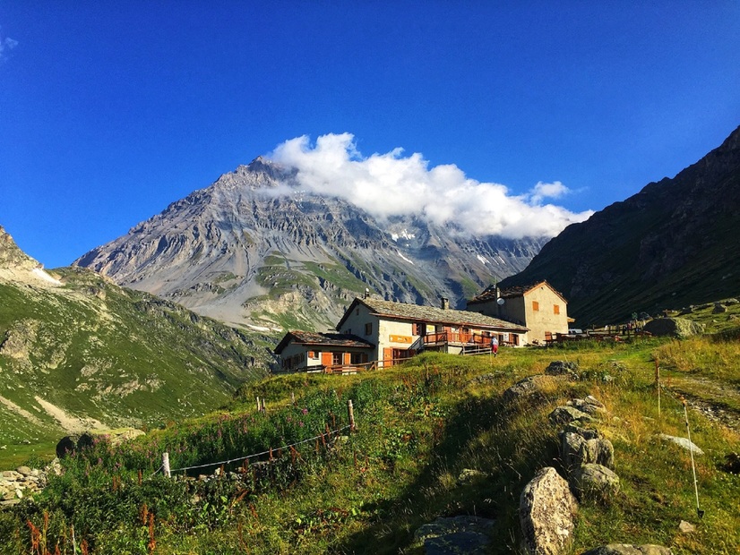
Do glaciers appeal to you? Nothing can quite match this adventure right at the heart of Vanoise National Park, in the magical high-mountain atmosphere. Step into the realm of the Leisse Valley. A whole new field of possibilities opens up to you.
Description
After passing Plan du Lac refuge, a real favourite for hikers, venture into a valley sculpted by the Leisse torrent. To the sound of whistling marmots, the glaciers of Vanoise appear tantalisingly close and yet distant. Make your way serenely aross the alpine meadow, where herds sometimes graze. Feast your eyes on the majestic peaks as you take a break at Saint-Barthélémy Chapel. Pointe de la Réchasse, Pointe Mattews and the prestigious Grande Casse stand guard with imposing authority. Nonetheless, Dent Parrachée and Dôme de Chasseforêt are not intimidated. As you cross the Rocheure riverbed, can you sense the magic of snow melting into torrents? Fierce in springtime, already calmer in summer... Though the glaciers are treating, the torrents keep flowing. Enjoy the tranquility of the mountain refuge for a food stop or a night at high altitude. In this seemingly endless valley, how far could you extend your journey? Tignes to the north, Pralognan la Vanoise to the west… Give in to a spot of daydreaming.
Period of opening
From 15/06 to 15/10 daily.
Subject to favorable snow and weather conditions.
Additional welcome
The duration of hiking trails is calculated using reference paces: 300 m/h ascent, 500 m/h descent and 4 km/h on the flat.
As hazards may occur at any time on the routes, the GPX tracks provided are not contractual. They are given for information only. Riders use them at their own risk, depending on their level of technological proficiency and their understanding of the terrain.
Equipment & services
-
Parking nearby
Prices
Free access.
Animals
Non acceptedPets are not allowed on this hike in the Vanoise National Park.
Localisation
By bus: Line 2 - Parking de Bellecombe stop
By bus: RD 126 from Termignon - Bellecombe parking lot (charge July-August).